Allols depression: salt, hot springs and caravans
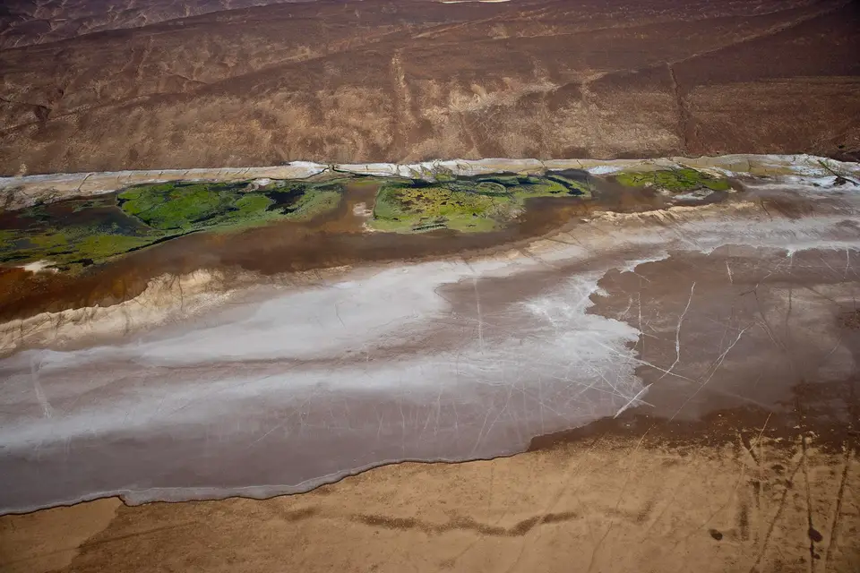
The Allols depression is a group of salt depressions north of Lake Assal, in the Tadjourah region. There you find vast expanses of salt, black rocks, old lava deposits, numerous hot water springs, small marshes and patches of greenery where the doum palm grows. Difficult to reach, the site is visited as part of organised excursions.
These are not swimming lakes. The Allols are a landscape of salt, rock and lava, crossed by hot springs and marshes. The site is difficult to reach: you go there as part of an organised trip, with a suitable vehicle.
Where is the Allols depression?
North of Lake Assal, in the Tadjourah region — the address recorded in the catalogue is “North of Assal Lake”. The sector presents itself as a wild landscape, difficult to reach, made of salt fields, black rocks and old lava deposits.
Its position defines it well: the depression occupies the north of Lake Assal, and the National Tourism Agency insists on the contrast, describing a landscape “very different” from that of the lake.
Key facts
| Reference | Data |
|---|---|
| Region | Tadjourah |
| Coordinates of the area | 12.020 N — 42.299 E |
| Location | North of Lake Assal |
| Landscape | Salt fields, black rocks, old lava deposits |
| Water | Numerous hot springs, small marshes |
| Water supply | Sea water through underground fractures (ANT factsheet) |
| Vegetation | Patches of greenery, doum palm, the tree from which palm wine is drawn |
| Access | Difficult; organised excursions |
| Published offers | No offer specific to the Allols; the Lake Assal excursion is the closest documented formula |
What do you see in the depression?
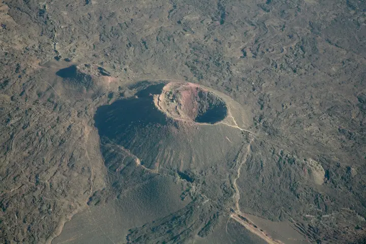
The landscape reads in three layers. First salt, in vast expanses. Then rock: black blocks and old lava deposits, witnesses of a volcanic past. Finally water, which surprises in such an arid environment — numerous hot springs and small marshes.
The National Tourism Agency adds a decisive element: the depression is fed with sea water through underground fractures. That explains at once the presence of hot water, the formation of salt and the existence, in the middle of this mineral landscape, of patches of greenery where the doum palm grows, the tree from which palm wine is drawn.
Contrast is the place’s main argument: the National Tourism Agency speaks of a landscape “very different from Lake Assal”, and that is exactly what people come looking for.
Where does the story of Allols salt come from?
The caravan trade that linked the Ethiopian highlands to lakes Assal and Allol goes back to Antiquity. Afar nomads carried salt in the form of slabs, on camel back, along rough paths — sometimes over several hundred kilometres.
Salt was not only a commodity. In the 19th century, it served as currency across much of the Horn of Africa, rivalling the Maria Theresa thaler issued in Ethiopia. The salt trade remains regulated and still continues today: the National Tourism Agency even offers a contemporary reading of it, following the caravan route on foot.
In other words, the Allols depression is not only a landscape: it is a place of work, movement and exchange, used long before tourism arrived.
How do you visit the Allols?
The site is difficult to reach, and that is the point to remember before putting it on the programme: you do not go there like Lake Assal, on a paved road. The visit goes through an organised excursion, with a suitable vehicle and accompaniment that knows the tracks.
The page 4×4 rental with driver explains what that kind of access involves in practice, and the Lake Assal page places the sector from a practical point of view: it is the logistical base for any approach to the Allols.
What can you combine with the Allols?
Lake Assal first, obviously: the body of water lies just south of the depression, and its salinity — 348 grams of salt per litre — tells the gap between the two sites, since at the Allols water appears as hot springs, marshes and salt fields.
Tadjourah next: the white city lies on the same trajectory, and the region holds other natural sites, such as the Korili hot springs, further south. The Tadjourah page covers the town, its beaches and its hinterland.
Finally, to place the Allols within a wider geography, the destinations hub lets you compare the country’s sites and build a coherent itinerary.
What should you know before setting off?
- Go through a supervised trip. The site is difficult to reach and has no landmarks: that is the condition of a calm visit.
- Be careful with the hot springs. They are natural water points, at variable temperature: do not bathe in them without checking on site.
- Plan for water and sun protection. The landscape is mineral, shade is scarce and reflection off the salt is strong.
- Time the trip to the right period. The page when to go to Djibouti gives the month-by-month calendar, to be set against the access constraints of the sector.
- Take nothing. Salt, stones, vegetation: what remains on site is part of the site.
Frequently asked questions
Where are the Allols?
North of Lake Assal, in the Tadjourah region. The address recorded in the catalogue is 'North of Assal Lake'. The sector is described as a wild landscape, difficult to reach, made up of salt fields, black rocks and old lava deposits.
How do you visit the Allols depression?
As part of an organised excursion: the site is difficult to reach and is not approached like a beach or a lake on a road. A suitable vehicle and accompaniment are necessary. The closest published packages go through Lake Assal, whose north the Allols depression occupies.
Why did Allols salt matter in the region's history?
The caravan trade linking the Ethiopian highlands to lakes Assal and Allol goes back to Antiquity. Afar nomads carried salt in slabs on camel back, along rough paths, sometimes covering several hundred kilometres. In the 19th century, salt served as currency across much of the Horn of Africa.
What do you see in the Allols depression?
Vast expanses of salt, black rocks and old lava deposits, but also numerous hot water springs, small marshes and surprising patches of greenery where the doum palm grows, the tree from which palm wine is drawn. The National Tourism Agency notes that the depression is fed with sea water through underground fractures.
Do the Allols look like Lake Assal?
No, and that is one of the interests of the site. The National Tourism Agency describes a landscape very different from that of Lake Assal: vast expanses of salt, hot water springs, small marshes and patches of greenery. Lake Assal, for its part, is a body of water whose salinity reaches 348 grams per litre.
Sources
Location
Lat. 12.02042Lng. 42.29850
Destinations
Read next
Abourma: the rock engravings of the Makarrassou massif
Ali-Sabieh: the south-east region, sites and camps
Ardoukoba: the most recent volcano in Djibouti
Arta: the cool of the interior and whale sharks
Assamo: the protected area of the beira antelope
Balho: rock art and the northern border post
Bankoualé: the oasis at the foot of the Goda massif
Daasbiyo cave: rock paintings and burial mounds