Seven Brothers archipelago: diving at the entrance to the Red Sea
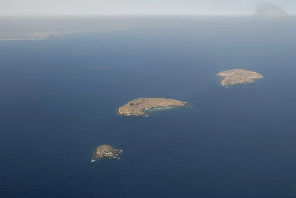
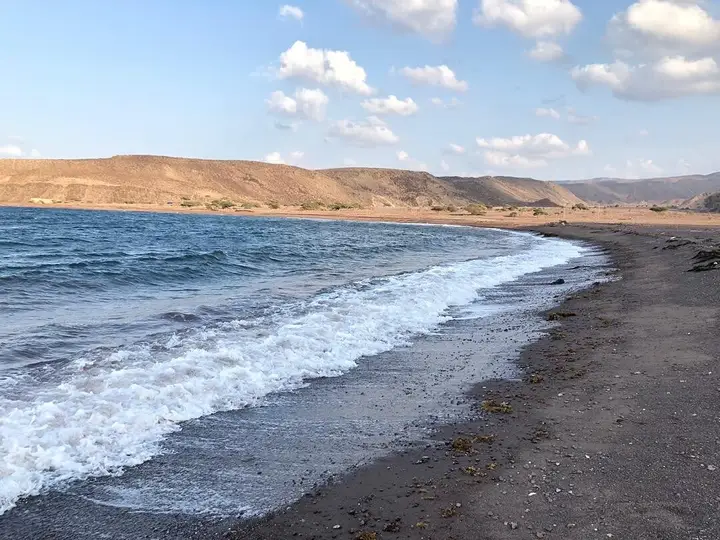
The Seven Brothers archipelago, or Sawabi islands, is a string of volcanic islets in the north of the Obock region, east of the Ras Siyan peninsula, just before the southern entrance to the Bab el-Mandeb strait. The group counts six islands: the 'seventh brother' is Ras Siyyan itself. The area falls under a Unesco biosphere reserve and a marine protected area whose surface the Dalmar catalogue puts at 447.1 km².
Two protected perimeters, not to be confused. The Dalmar catalogue puts the Seven Brothers marine protected area at 447.1 km². Unesco’s Man and the Biosphere programme lists a much larger biosphere reserve — “Archipel des Sept Frères – Ras Siyyan – Khor Angar – Godoria” — which takes in the mainland mangroves. These are two distinct designations, with two distinct perimeters. We give both figures rather than merging them into one.
Where is the Seven Brothers archipelago?
The archipelago occupies the north of the Obock region, east of the Ras Siyan peninsula, just before the southern entrance to the Bab el-Mandeb strait, where the Red Sea meets the Gulf of Aden. The islands are also called Sawabi.
Despite their name, they are not seven. The key biodiversity areas listing describes an archipelago of six small volcanic islands, and specifies that the Ras Siyyan peninsula, not included in the site, “forms the seventh member of the group, from which the archipelago takes its name”. The Wikipedia article on the archipelago gives the names: East island (Ounda Komaytou), South island (Horod le Ale), Grande Île (Kadda Dâbali), Low island (Tolka), Double island (Ounda Dâbali) and West island (Hamra).
These are islets of volcanic rock, almost devoid of vegetation according to the same listing, and without fresh water. The catalogue describes them as a string of islands scattered in the strait; the two readings meet: a mineral environment, beaten by wind, surrounded by deep water.
What does the legend of the Seven Brothers tell?
The Dalmar catalogue reports a local legend of pirates. The brothers Tolka, Saba, Kakka Dâbali and Rounda Dabali are said to have accumulated considerable booty before falling out. Each is said to have fled on his yole; a storm swallowed them, and the islets are said to carry their names today.
That story is not history: it is a tale passed on orally, and nobody claims otherwise. It does explain why several place names of the archipelago carry people’s names — Tolka, Dâbali — and why the islands are associated, in the local imagination, with a sea that keeps what is entrusted to it. The name “Devil’s islands”, used for the islets of Goubet al-Kharab further west, belongs to the same register.
The key biodiversity areas listing adds a contemporary element: the site is visited sporadically by divers, and by fishermen largely Yemeni. The archipelago is therefore not only a dive site: it is also a waypoint on an old maritime route.
What do you see underwater, site by site?
The catalogue describes each island through its seabed. The table below reports its claims, without turning them into promises.
| Site (catalogue name) | What the catalogue announces |
|---|---|
| East island | An “aquarium” between 5 and 10 m deep |
| South island | Dives down to 50 m: giant groupers, sharks, trevallies in numbers in May and September |
| Grande Île | The “Japanese garden”, frequented by whitetip sharks |
| Low island (Tolka) | The “underwater arch”, in full current, reserved by the catalogue for experienced divers; a small aquarium out of the current |
| Red island | A coral garden at 4 m: soft corals, nurse sharks, giant barracudas |
| Mouloule islet | Dives the catalogue does not detail |
Two caveats. First, these depths are the catalogue’s claims: they describe sites, not individual dives, and current can change the real difficulty of a site reputed to be easy. Second, the key biodiversity areas listing notes that diving remains little practised in this sector: expect fewer facilities than at the Moucha and Maskali islands, and conditions to be checked on site.
What is the protected status of the archipelago?
The area carries two protections, which we present separately because they do not cover the same thing.
The Seven Brothers marine protected area is put at 447.1 km² by the Dalmar catalogue, or, according to those data, 27% of the country’s coastal fringe.
The Unesco biosphere reserve bears a longer name — “Archipel des Sept Frères – Ras Siyyan – Khor Angar – Godoria” — and a far larger surface: 272,160 hectares, of which 197,574 hectares marine, with 2025 as the year of nomination. It therefore includes the mainland mangroves, and not only the islands.
| Reference | Data | Origin |
|---|---|---|
| Seven Brothers marine protected area | 447.1 km², or 27% of the coastal fringe | Dalmar catalogue |
| Biosphere reserve (whole) | 272,160 ha, of which 197,574 ha marine; nomination 2025 | Unesco, Man and the Biosphere programme |
| Species recorded in the reserve | More than 970, including 12 marine mammals and 520 reef fish species | Unesco, Man and the Biosphere programme |
| Corals | 238 species, of which 32 threatened | Unesco, Man and the Biosphere programme |
| Sea turtles | Four globally threatened species | Unesco, Man and the Biosphere programme |
| Migratory birds of prey | 85,000 to 245,000 per year | Unesco, Man and the Biosphere programme |
| Mangroves | Ras Siyyan, Khor Angar and Godoria: the largest and most diverse in the country | Unesco, Man and the Biosphere programme |
| Region | Obock, north of the country | Catalogue |
What these figures tell is simple: the place owes its interest to a meeting between two bodies of water. The warm waters of the Red Sea, coming from the north and west, cross cold, nutrient-rich upwellings from the east, from the Somali-Arabian system — a mix that produces an unusual coral habitat, described as one of the most species-rich marine areas on the planet.
Can beginners dive at the Seven Brothers?
Some of the sites described by the catalogue are shallow: the aquarium off East island is announced at 5 to 10 metres, the garden of Red island at 4 metres. Those are depths for snorkelling as much as for scuba diving.
Everything then depends on the current. The “underwater arch” off Tolka is described in full current and reserved by the catalogue for experienced divers; South island is announced down to 50 metres. Those two sites are not for a first level.
The practical rule is simple: state your level and your real experience to the operator, and let them choose the sites. Sea conditions, on the other hand, are not negotiable — the trip can be cancelled the same morning. To place the archipelago within the country’s diving offer, see our page on diving in Djibouti.
What is there to do on land, around the Khor-Angar mangrove?
The catalogue describes a camp set up on the banks of the Khor-Angar mangrove, in the north of the Obock region. The site is presented as a maze of channels and mangrove roots covering, according to those same data, 700 to 800 hectares.
That mangrove is not a local detail. For the Man and the Biosphere programme, the mangroves of Ras Siyyan, Khor Angar and Godoria form the largest and most diversified systems in Djibouti.
The activities announced at the camp are varied: mangrove visits, amateur and sport fishing, scuba diving, birdwatching, but also quad bikes, motocross and kitesurfing. Not all are practised in the same place or the same season; ask the operator what is actually open during your stay. Birdwatching alone has plenty to offer: the sector is described as one of the most important raptor migration corridors in the world.
To sleep in this sector, our page on camps and ecolodges lists the available formulas, and the one on Obock places the archipelago within the whole of the country’s north. If you are coming for the sea, boat rental is the logistical building block to settle before leaving.
How do you visit the archipelago without damaging it?
The archipelago is a protected area, and it is fragile for a simple reason: coral reefs recover poorly from contact, anchoring or removal. The key biodiversity areas listing notes breeding seabirds and turtles there, two groups sensitive to disturbance.
- Touch neither the coral nor the living sand, and keep neutral buoyancy above the reef masses.
- Do not anchor on the reef: ask the skipper to moor on clear areas, or to stay drifting.
- Do not feed the animals and do not chase a shark for a photo.
- Do not land on the islets during the nesting season of seabirds and turtles: disturb as little as possible.
- Take nothing: no shell, no coral, no sand.
- Carry your waste back, including what might seem biodegradable.
- Allow a day of margin in your programme: a sea trip is cancelled for wind or swell, and there is no guaranteed catch-up the next day.
The season matters too: for the general logistics, see when to go to Djibouti.
Frequently asked questions
How many islands are there in the Seven Brothers archipelago?
The group counts six islands, and the 'seventh brother' is the Ras Siyan peninsula, which attaches the whole to the coast. That inventory is confirmed by the key biodiversity areas listing, which states that Ras Siyyan is not counted in the site because it is part of the mainland. The name is therefore an image. The Dalmar catalogue uses other spellings, such as Tolka or Red island.
Can beginners dive at the Seven Brothers?
Yes, but not everywhere. The catalogue data locate shallow sites, such as the 'aquarium' off East island announced at 5 to 10 metres, or the coral garden of Red island announced at 4 metres. Conversely, the 'underwater arch' off Tolka lies in full current and the catalogue reserves it for experienced divers. Have your level validated by the operator before booking.
Which species can you observe at the Seven Brothers?
The reefs hold hard and soft corals, whitetip sharks, nurse sharks, giant barracudas, trevallies, groupers and giant groupers. The biosphere reserve lists more than 970 species, including 520 reef fish species and 238 coral species, as well as four threatened sea turtle species and dugongs. No sighting is guaranteed: these species are present on the site, they are not scheduled there.
How do you get to the Seven Brothers?
There is no regular service: you go by boat, with a local operator, most often from Obock, where the camp set up on the Khor-Angar mangrove also stands. We publish no crossing time, because it depends on the boat, the state of the sea and the departure point. Ask the operator for it and keep a day in hand.
What is the best period to visit the Seven Brothers?
The catalogue data note trevallies in numbers in May and September, and the Wikipedia article on the archipelago mentions whale sharks in the neighbouring Gulf of Tadjourah in November. We publish no guaranteed diving window: the archipelago is exposed to wind and current, and a trip can be cancelled. Plan for flexibility rather than a single date.
Sources
Location
Lat. 12.45989Lng. 43.41207
Destinations
Read next
Abourma: the rock engravings of the Makarrassou massif
Ali-Sabieh: the south-east region, sites and camps
Allols depression: salt, hot springs and caravans
Ardoukoba: the most recent volcano in Djibouti
Arta: the cool of the interior and whale sharks
Assamo: the protected area of the beira antelope
Balho: rock art and the northern border post
Bankoualé: the oasis at the foot of the Goda massif