Weather and climate in Djibouti: temperatures, seasons and high plateaux
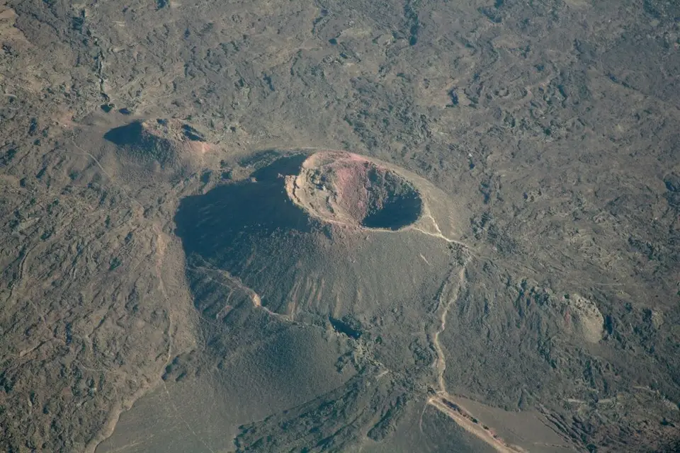
Djibouti has a hot desert climate. On the coastline, temperatures remain tempered by the sea and rarely exceed forty degrees. In the inland basins — Lake Assal, Lake Abbe, Gobaad — the bands we publish climb to 46 °C from June to August. The high plateaux, around the Goda massif and the Mabla mountains, offer a relative coolness thanks to altitude.
What is the weather like in Djibouti?
Djibouti belongs to the hot desert climates. Two mechanisms govern everything else: the sea, which tempers the coastline all year, and altitude, which creates separate worlds within a territory that is nonetheless tiny.
You go from sea level to the high plateaux in a morning of 4×4. The bands we publish for the Lake Assal depression, 155 metres below sea level, climb to 46 °C from June to August; further inland, the Dittilou cirque offers a relative coolness.
That opposition is the key to all planning: the useful question is not “what is the weather in Djibouti”, but “where in Djibouti am I”.
What is Djibouti’s climate, month by month?
| Month | Interior (basins) | Coastline | Rain | Sea | Wind | Crowds | Rating |
|---|---|---|---|---|---|---|---|
| January | 24 – 28 °C | Hot and dry | Rare | Warm | Moderate | High | ★★★★★ |
| February | 24 – 28 °C | Hot and dry | Rare | Warm | Moderate | High | ★★★★★ |
| March | 27 – 32 °C | Hot | Showers possible | Very warm | Moderate | Moderate | ★★★★☆ |
| April | 27 – 32 °C | Hot and humid | Showers possible | Very warm | Light | Moderate | ★★★★☆ |
| May | 32 – 37 °C | Very hot | Dry | Very warm | Light | Low | ★★☆☆☆ |
| June | 38 – 46 °C | Oven-like on the coast | Dry | Very warm | Strong in spells | Very low | ★☆☆☆☆ |
| July | 38 – 46 °C | Oven-like | Dry | Very warm | Strong in spells | Very low | ★☆☆☆☆ |
| August | 38 – 46 °C | Oven-like | Dry | Very warm | Strong in spells | Very low | ★☆☆☆☆ |
| September | 35 – 40 °C | Very hot | Dry | Very warm | Light | Low | ★★☆☆☆ |
| October | 26 – 31 °C | Hot | Rare | Warm | Light | Moderate | ★★★★★ |
| November | 26 – 31 °C | Hot and dry | Rare | Warm | Moderate | High | ★★★★★ |
| December | 26 – 31 °C | Hot and dry | Rare | Warm | Moderate | High | ★★★★★ |
Where those bands come from. The “Interior” column takes the temperature bands we publish on our Lake Assal page. They are derived from the Open-Meteo ERA5 reanalysis normals, period 2015-2024, published under licence CC-BY-4.0: for the Lake Assal basin, the monthly mean of the maxima peaks at 44.7 °C in June. These are ten-year normals, rounded into bands, and not daily readings. They describe the floor of the collapse basins, exposed to radiation and deprived of sea breeze.
Coastline or high plateaux: what are the differences?
| Zone | Altitude of the reanalysis sites | Climate | Sites concerned | To know |
|---|---|---|---|---|
| Coastline | 5 to 6 m — Djibouti City, Tadjourah, Obock | Hot, tempered by the sea, humid in summer | Djibouti City, Tadjourah, Obock, Sables Blancs | The most bearable in summer |
| Inland basins | −155 m — Lake Assal | Oven-like, dry, without shade | Lake Assal, Goubbet al-Kharab, lava fields | To be visited before 11 am |
| Southern plains | 240 m — Lake Abbe | Very hot, semi-desert | Grand Bara, Gobaad, Lake Abbe, Abourma | Long track, no shade |
| High plateaux | about 1,400 m — Forêt du Day and Goda massif | Cooler, more humid, dense vegetation | Forêt du Day, Goda mountains, Dittilou, Mabla mountains | Cool nights, plan for a layer |
The altitudes above are those of the Open-Meteo ERA5 reanalysis sites cited in the “Sites concerned” column. For the other reliefs, we refer to the National Tourism Agency’s “Relief” page, which gives three markers:
- Mount Moussa Ali, 2,020 m — the highest point in the country, in the north;
- Goda massif, 1,750 m, which carries the primary Forêt du Day;
- Mablas massif, of the order of 1,370 to 1,380 m according to the source (1,380 m for the agency, 1,370 m for our destinations catalogue).
Those two massifs are, with the Forêt du Day, the only parts of the country with permanent plant cover. Note that Moussa Ali appears in no ordinary tourist itinerary: it is a reference summit, not an excursion.
The Goda massif gathers, around the town of Day, the country’s high plateaux: that is where the Forêt du Day and the Dittilou cirque stand. The Mabla mountains, in the north of the Obock and Tadjourah regions, are also high reliefs, and shelter several named summits. It is in those reliefs that the last remnants of the country’s primary forest survive.
Why is it hotter in the basins?
Three factors accumulate in the Lake Assal depression. The altitude is negative: the floor of the basin lies 155 metres below sea level, therefore in a layer of compressed and warmed air. The black volcanic walls absorb radiation and give it back. Finally, the crust of salt and gypsum reflects the light like a mirror, which greatly increases exposure.
The result is felt on the ground: the salt and the rock become hot enough to burn through a thin sole. The hot springs bordering the lake — including the Korile spring — are scalding, to the point that you do not dip a hand in. We publish no temperature for those springs, for lack of a reading we could cite.
So it is not the air temperature that makes the visit punishing, but the radiant load. That is why a site at 32 °C on the thermometer can be more dangerous, at midday, than a site at 38 °C under the trees of the Goda mountains.
When does it rain in Djibouti?
There is no rainy season comparable to that of the neighbouring Ethiopian highlands. Precipitation is low, irregular and concentrated in a few episodes.
Those episodes take the form of brief, violent storms. The wadis, dry most of the time, fill within hours and can cover the salt plain of Lake Assal with several centimetres of water. The southern and northern tracks then become temporarily impassable, including in a 4×4.
In practice: a shower does not ruin a stay, but it can shift an excursion by a day. Allow a margin before a return flight and check the state of the tracks with your hire company or your camp.
What should you know about wind and the sea?
The coastline is ventilated for much of the year, which makes the heat more bearable than inland. In summer, spells of stronger wind can hamper boat outings and raise a choppy sea at the entrance to the Gulf of Tadjourah.
The sea stays warm all year, with no marked drop in winter: that is what allows swimming and diving at any time. We publish no sea surface temperatures in degrees: the normals we have do not cover the gulf at that resolution, and we prefer a qualitative assessment to an invented figure.
In practice: plan for a short wetsuit for long dives, and wind protection for crossings in a fast boat.
How should you protect yourself from the heat and the sun?
- Shift the hours. On the inland sites, set off before 7 am and leave before 11 am. The useful window is narrow.
- Drink before you are thirsty. Allow at least three litres of water per person per day, more in the basins.
- Cover up. Light long sleeves, a wide-brimmed hat and category 3 or 4 sunglasses protect better than short clothing.
- Be careful with the salt. After a swim in Lake Assal, rinse immediately with fresh water: the crystals abrade the skin as they dry.
- Recognise the serious signs. Persistent headaches, nausea, dizziness, dry and burning skin: stop the effort, get into the shade and cool the body down. There is no organised rescue on those sites.
What equipment should you take according to the season?
In the cool season (October to April), the day calls for light, breathable clothing, but nights in a bivouac in the south or on the high plateaux justify a fleece and a windbreaker. In summer (June to August), a hat, two T-shirts a day and an insulated flask make the difference.
On all the lava sites, closed shoes are essential: basalt is sharp and burning. Add a head torch for pre-dawn starts and a power bank, electricity being rare outside the camps.
To choose your dates according to those constraints, see the page when to go to Djibouti. For journeys and access to the sites, see car hire in Djibouti.
Frequently asked questions
What temperatures are there in Djibouti in summer?
On the coastline, the sea tempers things: Djibouti City remains very hot but bearable if you avoid the middle of the day. In the inland basins, on the other hand, the heat becomes oven-like and the bands we publish for Lake Assal climb to 46 °C from June to August. The salt and basalt ground throws that heat back and there is almost no shade on those sites.
When does it rain in Djibouti?
Rain is rare and irregular, with no rainy season comparable to that of neighbouring Ethiopia. Showers occur mainly in late autumn and in spring, and often take the form of brief, violent storms that fill the wadis within hours. The rest of the year the sky stays clear. We give that rain qualitatively rather than in millimetres.
Is it cooler on the high plateaux of Djibouti?
Yes, and that is the most useful gap to know. The Goda massif carries the country's high plateaux, where the Forêt du Day stands; the Mabla mountains are also high reliefs. Temperature drops markedly there, the air is more humid and the vegetation is dense: it is for that very reason that the Forêt du Day, the country's only national park, survives there.
What is the best climatic period to visit Djibouti?
From October to April. The heat comes down in the inland basins, nights become bearable again in bivouac and the walks of Lake Abbe or Abourma are workable. It is also the period when the sea is most pleasant and when whale sharks come back into the Gulf of Tadjourah. June to August suits only the coastline and diving.
What clothes should you take to Djibouti according to the season?
Cover up rather than strip off. In summer as in winter, plan for light long sleeves, a wide-brimmed hat, sunglasses and closed shoes for the lava sites. Add a light fleece and a windbreaker if you go up to the high plateaux or sleep in a bivouac: nights there are markedly cooler than by the sea.
Sources
Practical
Read next
4×4 with a driver in Djibouti: prices and itineraries
Accessibility in Djibouti: what a demanding trip implies
Boat hire in Djibouti: trips out to sea
Budget in Djibouti: what does a trip cost on the spot?
Buses and taxis in Djibouti: fares by zone and route
Car hire in Djibouti: 4×4, saloon or driver?
Connectivity and SIM cards in Djibouti: internet and mobile
Djibouti airport transfer: taxi, fares and arrival